 GPS has hit the mainstream, but it wasn’t long ago that the concept of in-auto navigation didn’t even exist. Here’s how we got to where we are today.
It’s tough to believe, but in-car GPS navigation has already been around for more than a decade. Yet were it not for politics—and Einstein’s theory of relativity—we wouldn’t even have it in the first place.
Twenty years ago, a road trip meant a bunch of fold-out maps stuffed into your glove box or your car door panel pockets. Pulling over, unfolding one like a giant newspaper, and then figuring out where you were and how it corresponded to what you were seeing through the windshield was the norm. Along the way, those maps gave way to MapQuest or Yahoo Maps print-outs, and now, fortunately, we’ve got portable navigation devices (PNDs), in-dash GPS systems, and GPS-enabled smartphones. Voice-enabled navigation is more commonplace than ever, as the average PND price keeps getting lower and lower, and high-quality navigation apps are available for most smartphones. Android phones even come with free Google Maps with driving directions.
But to figure out how we got here, we need to first look at how it all began.
Einstein and the Origins of GPS
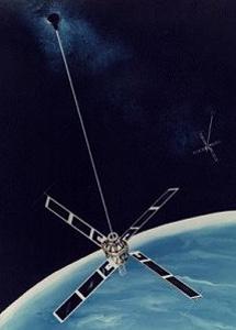
The U.S. Department of Defense first developed satellite-based global positioning technology for the military. An early satellite-based system dubbed TRANSIT was up and running as early as 1960, with more refined and precise versions involving multiple satellites in general military use by the early 1980s (pictured, right). But it wasn’t until 2000 that precision GPS navigation became open to the public.
Publicly available GPS devices had already been around since the early 1980s. But the military added interference to the signals to ensure their own version was the only one that could be used with any precision. After four years of deliberations, President Clinton signed a bill in 2000 ordering the military to cease scrambling satellite signals used by civilians. This instantly upgraded the accuracy of the few consumer-based systems already in existence by a factor of 10, and opened the doors to a much larger, consumer electronics-based industry for GPS navigation.
Today, a network of 24 U.S.-based GPS satellites orbit the earth, ensuring that at least three are available at any one time for a device’s position request anywhere on the globe. Russia’s own GLONASS system of 22 satellites will soon work with some compatible smartphones in the U.S. for additional accuracy.
Most people don’t realize that in order for global positioning to work, Einstein’s theories of special relativity and general relativity must come into play. On a basic level, GPS finds your position by looking at the time stamp from a number of satellites orbiting the earth, how far away each one is from you, and how far apart each one is from the other. With that data, the system triangulates your position on the ground. But because of relativity, the clocks in the satellites advance ever so slightly faster than clocks on the surface of the Earth. Plus, moving clocks are slower than ones standing still—again, by a very tiny amount.
While those two effects work against each other, the net result isn’t equal: You end up with a discrepancy of roughly 38 microseconds per day. That incredibly small difference is still enough to report your actual position off by miles, which would render the GPS system worthless, were it not for allowing for relativistic effects.
The Road to In-Car Navigation
Even after 2000, it would be a while before consumers would see GPS navigation in cars en masse. Fortunately, the dot com boom was already coming to the rescue. Beginning around the turn of the century, computer-generated, turn-by-turn directions from websites like MapQuest were a common sight. Not only were these websites godsends for finding unfamiliar hotels and restaurants, but they also assisted plenty of small businesses heavily reliant on driving—think of home improvement contractors, real estate agents, and freight services, just to name a few examples.
Map-based websites weren’t perfect, though. Early routing algorithms were imprecise, and sometimes repeated steps over and over again—long lists of instructions that basically said to stay on the same road for 12 miles were a constant source of frustration. Plus, you still had to print them out and take them with you, which meant you needed to pull over to read the next few steps. And if you wandered off course, you were just as lost as you would have been with a map—worse, actually, if you left the actual map at home, since the printed directions were for one specific route.
Early built-in GPS navigation systems were a revelation—if expensive. The first-ever GPS navigation system for a production vehicle, GM’s GuideStar system for the 1995 Oldsmobile Eighty Eight (pictured, below left), cost just under $2,000 and wasn’t particularly accurate. Two of the most famous early models are Ford’s Microsoft-based Sync, and BMW’s iDrive, both of which have been heavily upgraded over the years. The latter became famous primarily for its deficiencies at its original launch in 2002, thanks to its unbelievably stubborn interface, and the fact that even normal controls like radio presets were buried in submenus.
When it came to actual GPS navigation, early built-in systems were pretty limited anyway, thanks to 2D map graphics, few catalogued points of interest, and little in the way of added features. Later systems added 3D map views and text-to-speech conversion. The latest systems, powered by either QNX or Microsoft, and found in cars like the QNX-powered 2012 Audi A8, do a much better job of tying in navigation, entertainment, and cell phone connectivity. In today’s cars, it’s common to pair your cell phone over Bluetooth, dial contacts with voice commands, and even stream Internet services like Pandora from your cell phone’s data connection in order to listen to music over the car’s stereo system.
Portable GPS and Smartphones
Standalone GPS devices were another revelation. By the mid-2000s, Garmin, Mio, Navigon, Magellan, TomTom, and others flooded the market with devices across multiple price points. These devices usually ran some form of proprietary software on top of a readily available OS like Embedded Linux or Windows Embedded CE. Eventually, as the decade rolled to a close and sales began to decline, the resulting market shakeout left only Garmin, TomTom, and Magellan standing. Prices have also fallen tremendously, with solid midrange devices offering real-time traffic and lifetime map upgrades for roughly $200, and high-end models with terrain mapping and higher resolution like the Garmin nuvi 3590LMT maxing out at $400. Even better, last year’s models can be found for well under $100.
So sales have begun to fall over the past few years. Several factors are contributing to the decline, but two reasons in particular stand out: Market saturation and cell phone apps. While GPS devices have received considerable upgrades over the years in functionality, most consumers bought one and just used it for years, without feeling any need to upgrade. None of the new functionality introduced in the past several years is truly necessary—just helpful, in varying degrees.
The most important changes over time relate to map data and the POI (point-of-interest) database. No one wants outdated directions if one of the listed roads are now closed, or if a better way opened up—and certainly, no one wants to search for a nearby Thai place, drive all the way there, and find out it went out of business last year and is now a Starbucks. The thing is, you can upgrade the maps in older devices for a fee, and now even newer devices often come with lifetime free map upgrades. Car manufacturers also offer map updates on a yearly basis, often on disc, but for staggeringly high prices; BMW wants $200 for a single iteration of map updates, for example.
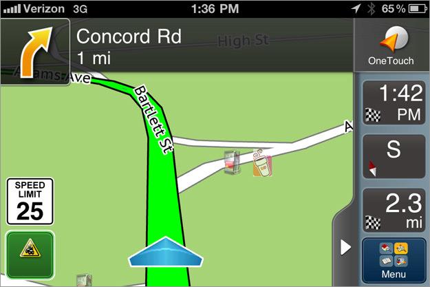
 That brings us to the second disruptor: smartphones. By the mid-2000’s, you could add GPS functionality to an existing phone with a Bluetooth-enabled GPS receiver. But it wasn’t long before smartphones began to come with integrated GPS—and by that I mean full-blown, voice-enabled navigation, not just the 911 emergency response system phones have had for years. TeleNav and Networks In Motion were early players on various cell phone platforms, offering voice-enabled directions for roughly $10 per month. Today’s smartphone apps, such as Magellan RoadMate for the iPhone (pictured, above), offer user interfaces indistinguishable from high-end PNDs, even if the GPS in the phones themselves still isn’t quite as accurate as standalone devices—yet.
The voice prompts are key. Many phones today come with free Google Maps apps, which will provide turn-by-turn navigation between two addresses, but these are impossible to use behind the wheel unless you have a passenger reading the directions out loud to you. Android phones come with voice-enabled Google Maps Navigation, which is an upgrade from the stock Google Maps icon found on most iPhones.
The Latest Tech and Challenges
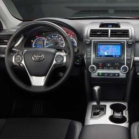
In-car navigation systems remain the most attractive and well integrated, as they continue to tie in more and more entertainment, safety, and cell phone-related features, like the system in the 2012 Toyota Camry (pictured, below right). They’re also more reliable, and they stay in the car and are always ready to work. And they’re difficult to steal and generally worthless to thieves—at least compared to a standalone GPS unit, a single- or double-DIN car stereo receiver, or a cell phone—all of which are tempting targets to a crook with a crowbar when left in the vehicle.
 In-car navigation faces several unique challenges, though. First and foremost are the development cycles. For years, system upgrades have corresponded with model revisions, which can take anywhere from four to six model years for the average mainstream vehicle. That’s not counting the long lead time for engineering and development, either. Consequently, a 2012 car could have a system originally designed in 2006 and put into production in 2008 when that model first hit the streets. There’s also the reliability aspect. No one driving a car has the patience to reboot the entire car at 75 mph on the highway—and that’s to say nothing of the horrific implications that would have for safety. This is primarily why you don’t see upgrades beside map updates very often.
Fortunately, original equipment manufacturers like QNX, which supplies the underlying GPS systems for many of today’s auto companies, are working to improve this process. Interestingly, open-source software like Linux and HTML5 code are increasingly coming into play.
“We look a lot like Linux from an API perspective,” said Andrew Poliak, director of automotive business development for QNX, to PCMag. “If you’ve written a Linux app, you can write a QNX app. We can take code from the Linux community, recompile that code, and then have it run on QNX for the most part. One disadvantage of Linux is that you have to open-source it, and it has proprietary information automakers don’t want hackers to access, which could negatively impact the way the vehicle functions. QNX lets automakers tap into the Linux community, without the scenario of being hacked because of open-source.”
Prices Really Are Coming Down
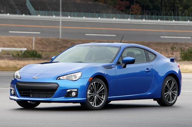
While both of the above reasons for infrequent upgrades and outdated systems are valid, there’s also the manufacturer’s own interest. A lot of frustration stems from the high prices of these systems, as well as how dated they seem compared with even $150 standalone GPS devices. You can bet auto manufacturers aren’t in a race to drop the price on an option that generates so much profit for them. Still, signs are encouraging. Mazda introduced the first sub-$500 navigation option on its 2010 Mazda3. The new-for-2013 Subaru BRZ (pictured, below) comes with navigation standard, which is unheard of on a $25,000 vehicle.

In general, the future looks bright. TeleNav recently gave us a ride in a car equipped with its new, cross-platform, HTML5-powered Scout GPS system, which promises to help bring down prices and offers more connectivity with your phone. Ford is hard at work at improving Sync, and is constantly adding new features like expanded app support via AppLink, as well as a new NPR tie-in. With the help of a custom hot rod manufacturer, Microsoft put together an impressive rolling tech demo: A Windows 8-powered Ford Mustang with integrated Microsoft Kinect, an Xbox 360, 4G LTE, smartphone connectivity, and several built-in projectors and cameras for use inside and outside the vehicle.
I’m pretty sure I can say future systems will cost less and be easier to use—and, if we’re lucky, will look a lot like what Microsoft and TeleNav are currently showing off. But we’ll have to see how much control auto manufacturers are willing to cede on something that currently makes them a lot of money. In the meantime, think of it this way: It’s never been easier to avoid getting lost.
Source: Pcmag
